Place
How neighbourhoods came to look the way they do
Most towns are a sequence of expansions, each one following whatever it was cheap to travel by at the time. The layers are still visible from the pavement.
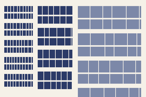
The older core
Irregular plots following field and route lines. Fine grain, buildings to the street, mixed uses on the same plot, few gaps.
Industrial expansion
Dense uniform terraces close to work, built quickly by speculative builders. Narrow frontages, long rear plots, back lanes.
The transport suburb
Development following a railway line or tram route outward, concentrated within walking distance of a stop. Wider plots, front gardens, deliberate uniformity.
Interwar expansion
Large areas of semi-detached houses on generous plots, curved streets, verges and set-back building lines. Built for a household expecting a car eventually.
Postwar estates
Planned layouts built as single schemes: consistent house types, shared green space, separated pedestrian routes, low permeability by design.
Later infill
Individual plots subdivided, back gardens built on, redundant sites redeveloped. Produces sharp local discontinuities in age, scale and material.
Transport is the organising fact
If there is one principle behind the shape of towns it is this: settlements extend as far as it is tolerable to travel to their centre, and the tolerable distance is set by the technology of the day. When walking was the only option, that distance was small, and the result was dense development at high grain packed close to work. Every subsequent improvement in transport pushed the boundary outward and lowered the density inside it, because land further out was cheaper and there was more of it.
This is why the layers are usually concentric in principle and messy in practice. Fixed lines - a railway, a tramway, a main road - pull development along themselves, so growth arrives in fingers rather than rings, and the gaps between the fingers fill in later. Where you can see a run of similar houses stretching away from a station and stopping abruptly, you are looking at the distance people were willing to walk from a stop.
The older core
The oldest part of a settlement is recognisable by irregularity. Plots are narrow and deep, boundaries are not parallel, streets bend for reasons that have disappeared, and buildings sit hard against the pavement because there was no reason to set them back and every reason not to waste frontage. Uses were mixed as a matter of course: workshops behind houses, stabling and storage on the same plot, accommodation above trade.
These areas have generally been rebuilt many times on the same lines. That is the point - the plot pattern is much older than anything standing on it, and it constrains what can be done to this day. It is also why buildings here are structurally various, often altered, and frequently share walls, drains and rights with their neighbours in ways that take some untangling.
Industrial terraces
Where industry concentrated labour, housing was built fast, in volume, and close by. Speculative builders acquired land in parcels, laid out streets, and put up runs of near-identical terraces, often stopping and starting as money allowed - which is why the material or detailing can change halfway along a street. Frontages are narrow because land per house had to be minimised; plots run back a long way, with a rear lane for deliveries and refuse.
The result is durable and adaptable housing that has outlived the reason it was built by a century or more. What was cheap accommodation next to work often becomes, once the work has gone and the area is quiet, some of the most sought-after housing in a town - close in, walkable, fine-grained and built in a period whose construction has aged well.
The transport suburb
Suburban expansion along railway and tram lines produced a distinct pattern: development clustered within a walk of a stop, plots noticeably wider, houses set back behind front gardens, and a deliberate aesthetic uniformity because the developments were marketed as a coherent proposition rather than assembled piecemeal. Bay windows, consistent boundary treatments and repeated house types across many streets are the signature.
Look for the stop even where it has gone. Disused alignments, a strangely wide road, a curve in a street pattern that no longer serves anything, or a run of shops in an otherwise residential area frequently mark where a station or terminus used to be, and the housing around it will be older and denser than what surrounds it.
Interwar expansion
The large areas of semi-detached housing that ring many towns represent a period of unusually rapid outward growth on cheap land, built to a formula: pairs of houses, generous plots, curved and crescent street layouts rather than grids, verges, set-back building lines, and space at the side that would later become a garage or an extension. These estates were designed around a household that expected to own a car, and their permeability is lower than the older grid but higher than what came after.
They are also, structurally, among the most consistent housing anywhere: built in a narrow window to similar specifications, they tend to reach the end of the lives of their components - roofs, windows, wiring, drainage - at similar times, which is why whole streets of them get reroofed within a few years of each other.
Postwar planned estates
Estates built as single planned schemes look different because they were designed as objects rather than grown as accumulations. Their signatures are consistent house types across a whole area, shared open space rather than private ground, footpath networks separated from roads, culs-de-sac instead of through-streets, and parking arranged in courts rather than on frontages.
The deliberate reduction in permeability was intended to keep traffic out of residential areas, and it does. It also means these areas can be difficult to cross on foot, that routes are longer than the map suggests, and that the relationship between the estate and the streets around it can be weak. Whether that reads as peaceful or isolated depends largely on the individual layout, which is a reason to walk one rather than judge it from a plan.
Infill, and why streets stop making sense
The most recent layer is not a place at all but a process: individual sites within already-built areas being redeveloped. A large garden divided, a redundant workshop or garage replaced with houses, a single plot rebuilt at greater density, a former institutional site turned over to housing. Infill produces the sharp local discontinuities that make some streets confusing - three or four periods within a hundred metres, plot widths that suddenly change, a building line broken by one property.
It is worth recognising because it is the layer that will keep arriving. When you see a large plot, a wide side garden, a low-density site surrounded by higher density, or a building visibly at the end of its life, you are looking at something that will probably be built on eventually. That is not a criticism; it is how towns have always worked, and every layer described above was somebody's infill once.